News
«Geoinformation Systems» UE participated in the activation of the International Charter Space and Major Disasters
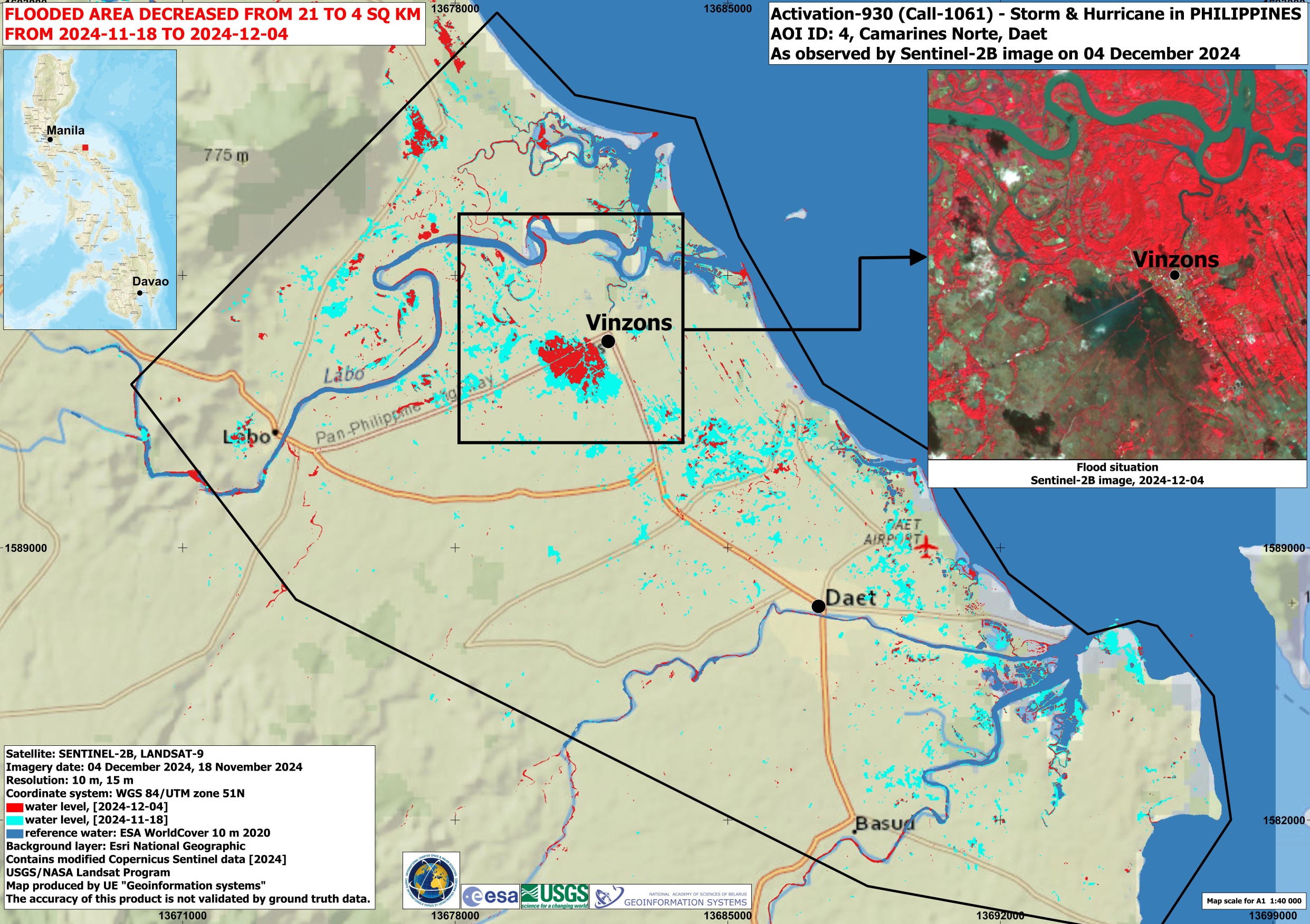
«Geoinformation Systems» UE participated in the activation of the International Charter Space and Major Disasters to assess the impact of the second tropical storm in the Philippines in last month from November 18 to December 5, 2024.
Super Typhoon Man-yi, with wind speeds of up to 185 km/h, hit the Philippines on November 17, 2024. More than 650,000 people were evacuated ahead of the storm.
The storm, which caused flooding and landslides, killed 8 people. Numerous buildings, roads and power lines were damaged. The initiator of the activation of the Charter resources was the United Nations Satellite Center (UNOSAT). The project manager was the United Nations Institute for Training and Research (UNITAR).
The rapid mapping service SERTIT (France), Mohammed Bin Rashid Space Center (UAE) and «Geoinformation Systems» UE were involved in the compilation of thematic maps. Space agencies of Brazil, Belarus, India, China, Russia, South Korea, the USA, France, Canada, Argentina, the European Union, Germany and the PLANET group of companies (USA) provided 638 programmed and archival images. Based on provided materials, «Geoinformation Systems» UE compiled and provided 6 thematic maps to the International Charter Space and Major Disasters.
Sources of information: Международная Хартия по космосу и крупным катастрофам