News
Participation in the activation of the International Charter on Space and Major Disasters
«Geoinformation Systems» UE participated in the activation of the International Charter on Space and Major Disasters to assess the consequences of flooding in Russia (Orenburg Region) from April 4 to May 2, 2024. Due to spring flooding in the Orenburg Region, more than 12,000 residential buildings in 73 settlements were flooded. Nearly 8,000 people were evacuated. The flooding began after a dam broke in Orsk, and parts of Orenburg were submerged. In Orsk, nearly 7,000 homes were flooded, and approximately 2,500 residents were evacuated. In Orenburg, 89 square kilometers of the city's area were flooded, affecting more than 6,500 households. The activation of the Charter's resources was initiated by the Russian Ministry of Civil Defense, Emergencies, and Remediation of Consequences of Natural Disasters (Russian MChS). Roscosmos (State Space Corporation) was assigned as the project manager. The Scientific Center for Operational Monitoring of the Earth of JSC Russian Space Systems (NTS OMZ) and Geoinformation Systems Unitary Enterprise were involved in thematic mapping.
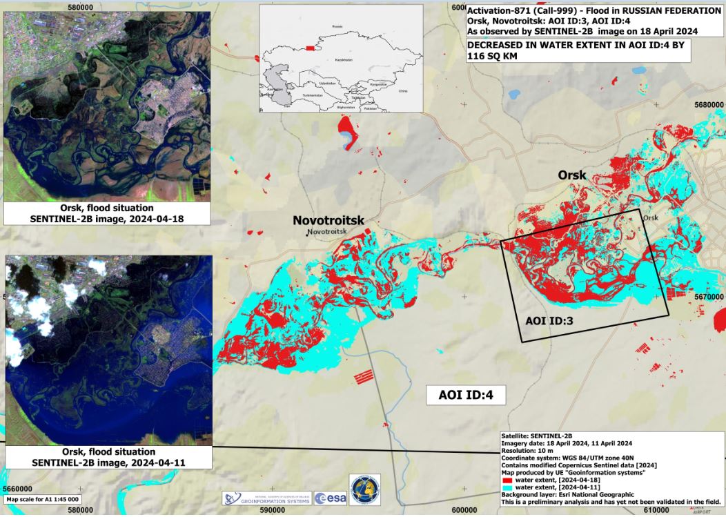
Space agencies from Brazil, the United States, China, Russia, Canada, Argentina, the European Union, and Venezuela provided 254 programmed and archival space images. Based on these images, «Geoinformation Systems» UE produced and submitted eight thematic maps to the International Charter on Space and Major Disasters.