News
«Geoinformation Systems» UE participated in the activation of the International Charter Space and Major Disasters
«Geoinformation
Systems» UE took part in the activation of the International Charter Space and
Major Disasters to assess the consequences of wildfires in Kazakhstan from
April 8 to 24, 2025.
Large forest and
steppe fires occurred in the Abay, Kostanay and Pavlodar regions. The situation
turned more complicated due to gusty winds and tall dry grass, which caused the
fire to spread faster. The burnt area reached more than 500 sq. km.
The activation of
the Charter resources was triggered by "Kazakhstan Gharysh Sapary" («KGS
NC») National Company.
«KGS NC» and the National Institute of Space Research of
Brazil (INPE) acted as project managers. «Geoinformation Systems» and INPE acted
as value adders in the compilation of thematic maps.
Space agencies
from China, South Korea, Brazil, Russia, the USA, France, the European Union
and PLANET USA Company provided 400 programmed and archival space images.
Based on the
provided data, «Geoinformation Systems» generated and provided five thematic
maps to the International Charter Space and Major Disasters.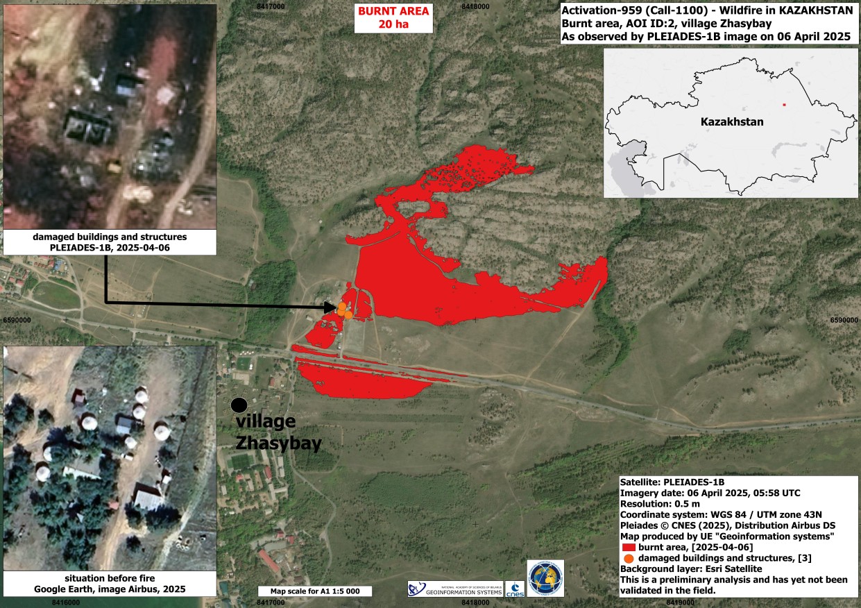
Information Source: The International Charter Space and Major Disasters