News
«Geoinformation Systems» UE participated in the activation of the International Charter Space and Major Disasters
«Geoinformation
Systems» UE took part in the activation of the International Charter Space and
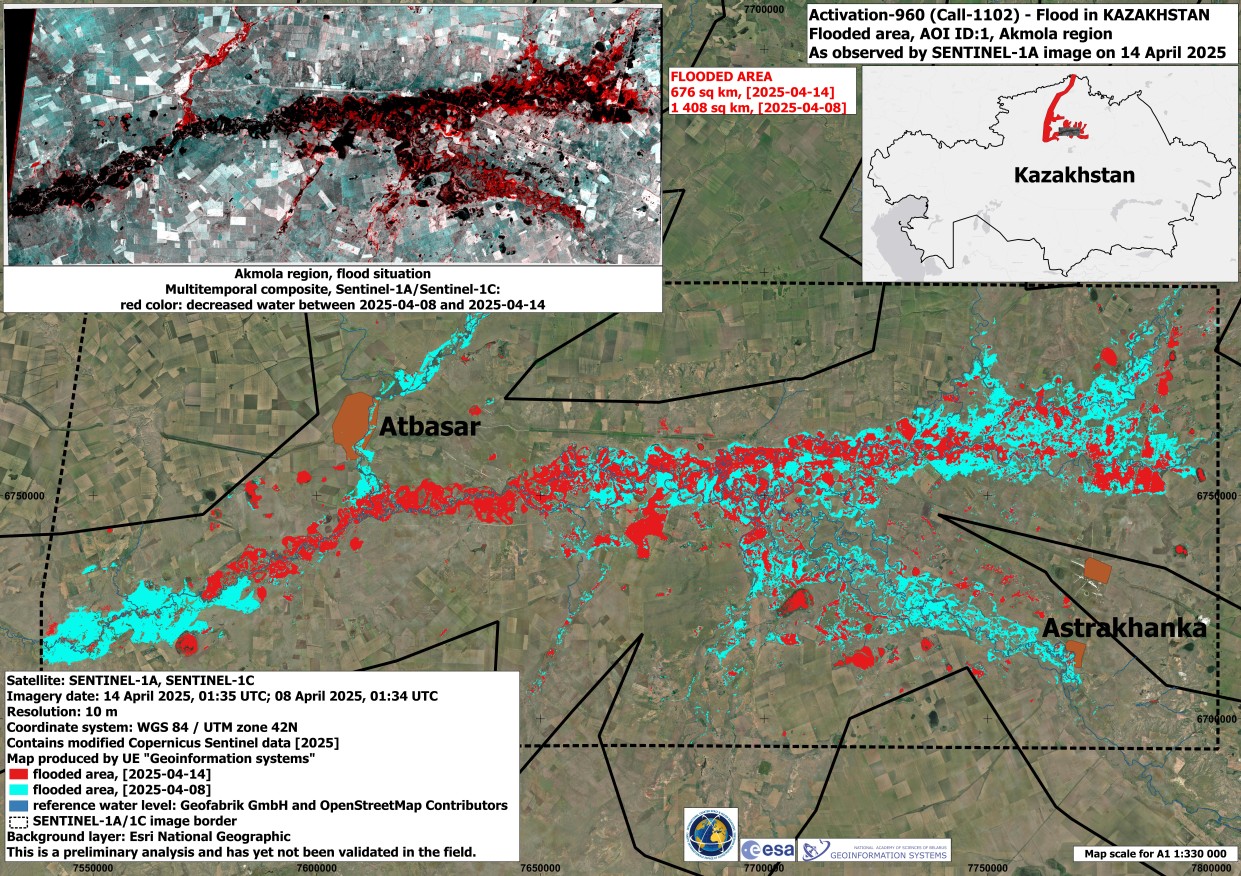
Major Disasters to assess the consequences of flooding in Kazakhstan from April
10 to 16, 2025.
In Akmola and
North Kazakhstan regions, nearby villages along the Ishim River were flooded by
meltwater. More than 500 people were evacuated.
26 overflows and five
washed-out sections were recorded on motorways, and 14 settlements were left
without public thoroughfares.
The initiator of
the activation of the Charter resources was "Kazakhstan Gharysh
Sapary" (NC "KGS") National Company. NC "KGS" and the
National Institute for Space Research of Brazil (INPE) acted as Project
Managers. «Geoinformation Systems» UE was involved in the compilation of
thematic maps as the Value Adder collaborating entity.
Space agencies
from China, South Korea, Canada, Russia, the European Union and Germany
provided 52 programmed and archival space images. On this basis, «Geoinformation
Systems» UP was able to produce and provide three thematic maps to the
International Charter Space and Major Disasters.
Information Source: The International Charter Space and Major Disasters